This approach has us look at land records to see who Joseph’s family/father may be.
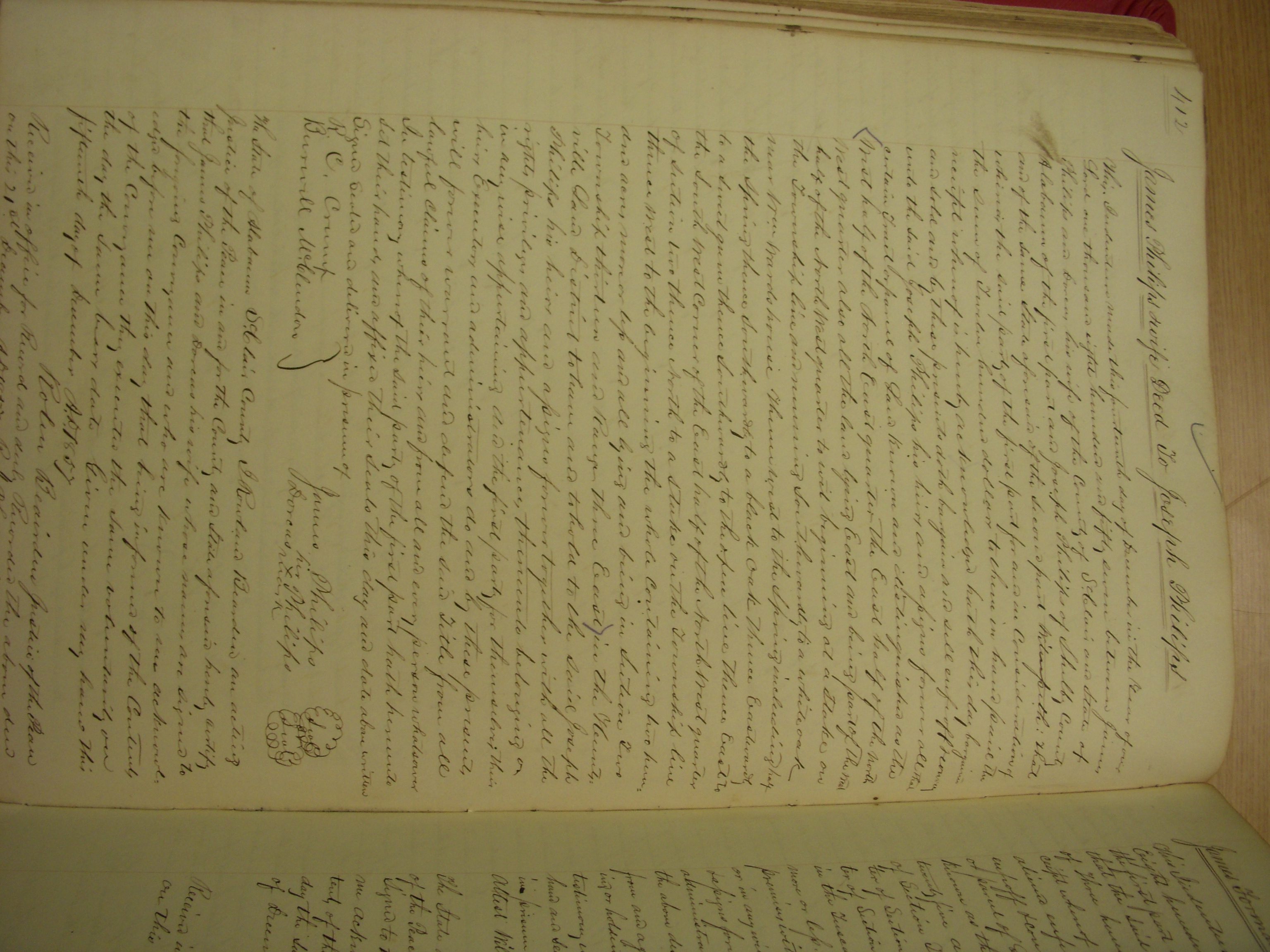
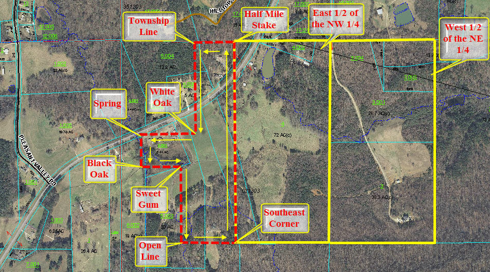
There is a piece of land located in Section 2, Township 13, Range 3 East. The description is as follows:
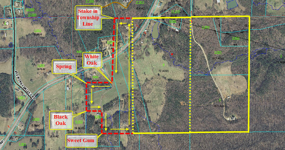
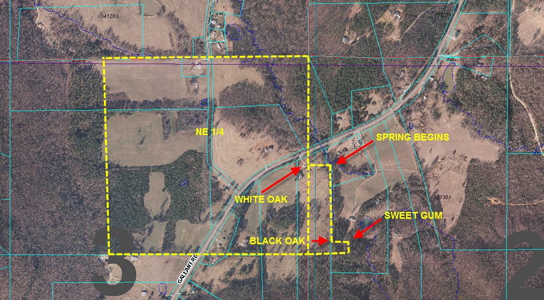
Beginning at the township line and running southwardly to a white oak thence west to the spring including half of the spring thence southwardly to a black oak thence eastwardly to a sweet gum thence southwardly to the open line thence east to the southeast corner of the above named quarter section thence north to the half mile stake on the aforesaid township line thence west to the beginning corner including all the north east half of the northwest quarter of section 2 of range and township aforesaid containing 120 acres, more or less.
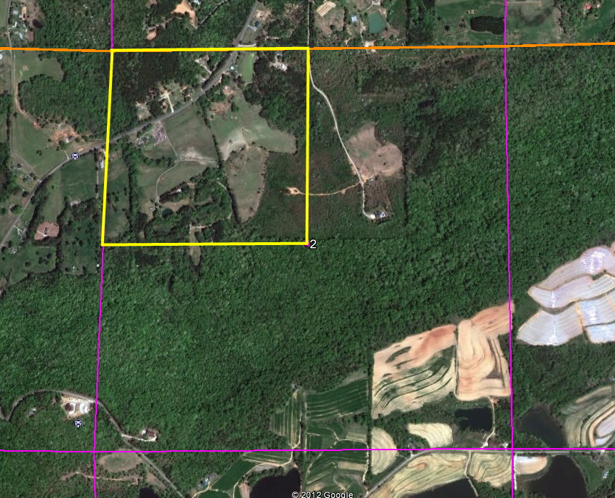
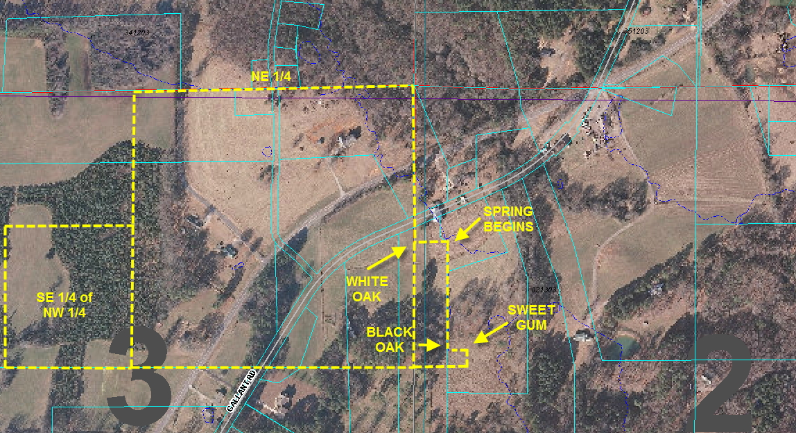
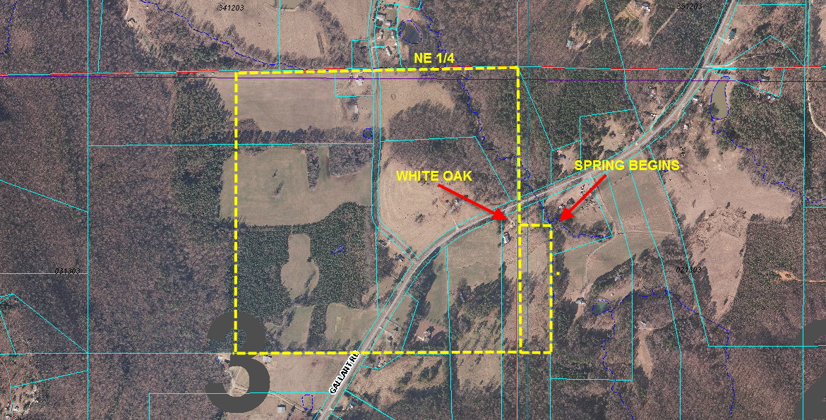
This is an image of the section and quarter section the deed is referring to. The road in the northwest corner is Gallant Road.
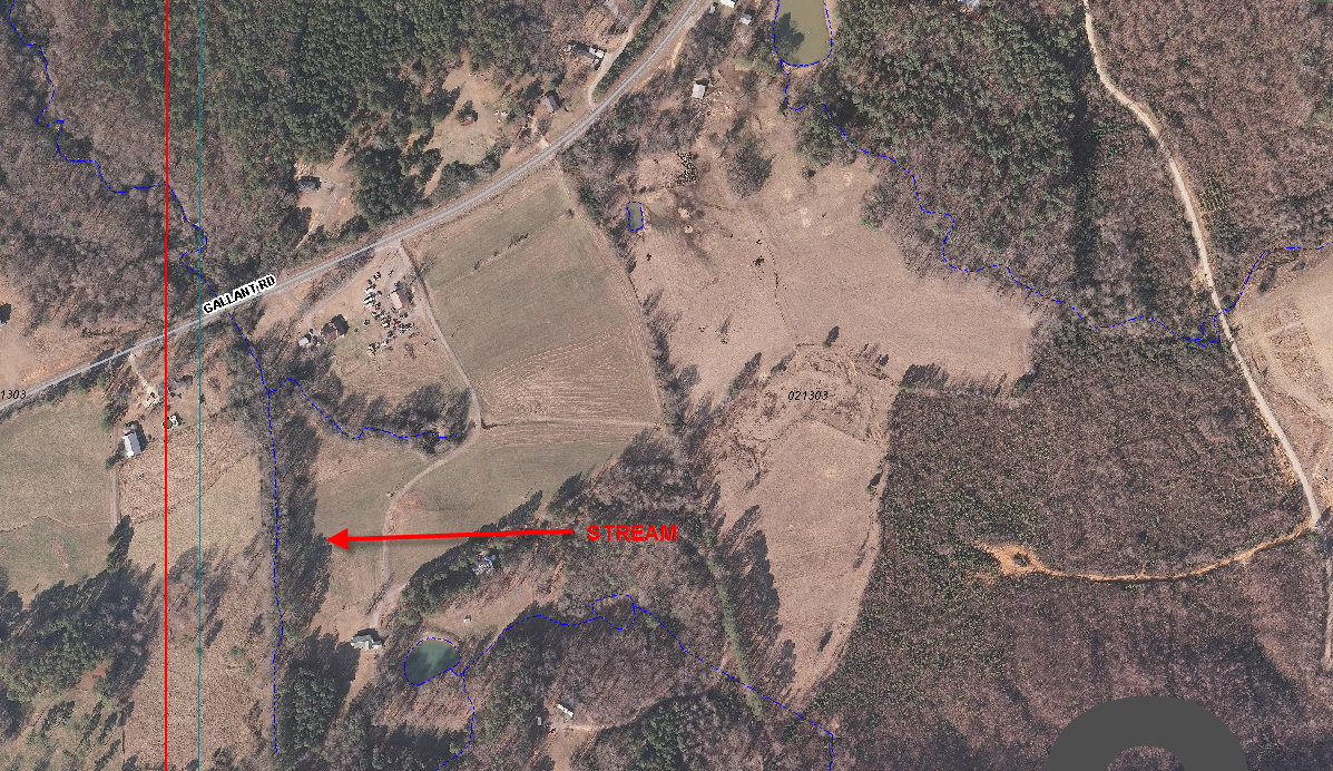
In this image you can see the current St. Clair County GIS image of the area the deed is referring to. This is a tax map image of the same site. The dark blue lines indicate that there is a stream, river or other water source located under the line.
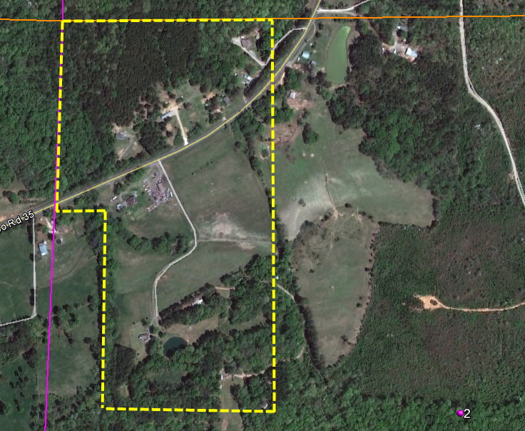
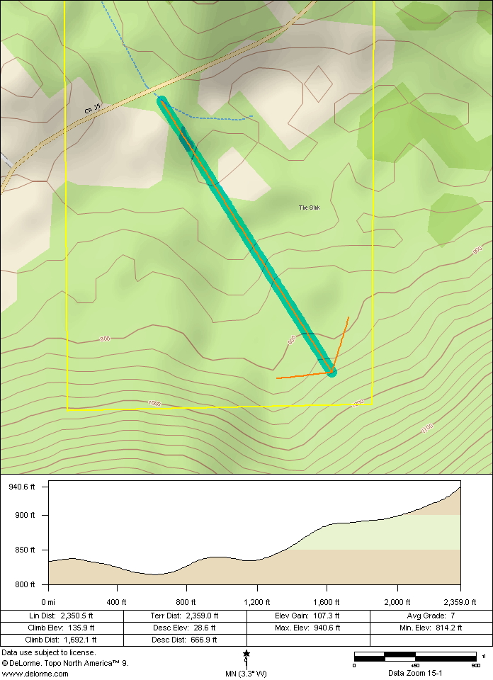
This image shows the rough outline of the parcel. Notice that the stream lines up with the rows of trees in the southwest portion of the property. Here’s a topographical map.
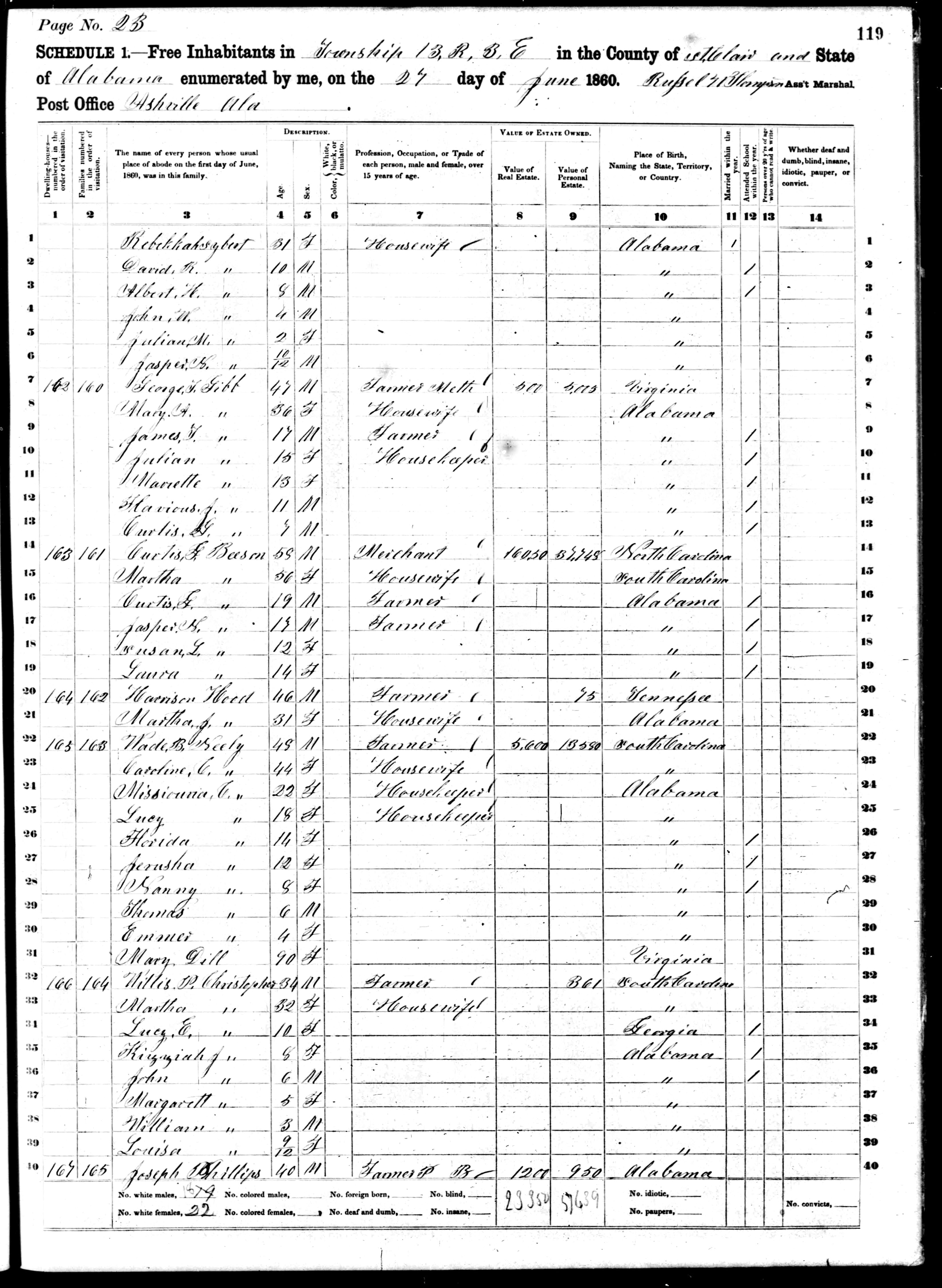
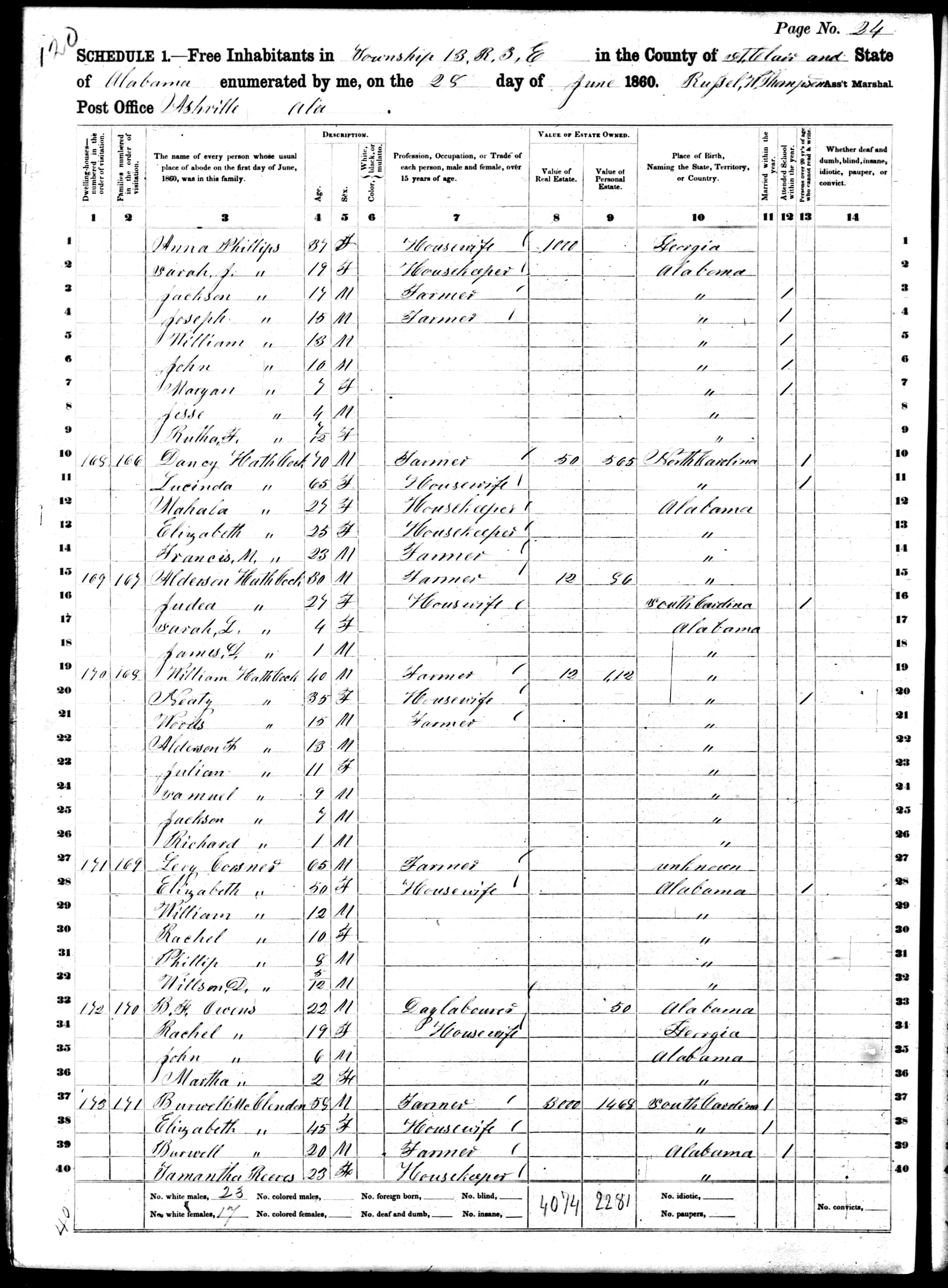
This is the legal description overlaying a satellite image of the land Joseph purchased from James and Dorcas Phillips on 14 December 1857 for $1,200. The deed is witnessed by Burwell McClendon and R.C. Crump who were neighbors. Burwell McCLendon is also enumerated on the following page in the 1860 census (the same page that lists Anna Copeland and the rest of the children). These two facts indicate that this was the land Joseph and Anna were living on during the 1860 census. (and here’s the rest of the family)
James and Dorcas (Crawford) Phillips purchased this land (Page 1, Page 2) from William and Lucinda Washburn on 12 August 1856 for $500. (Here’s the satellite overlay) James and his wife took out a mortgage (Page 2) the same day from Byers & Rowan for $814.41 that was to be repaid (plus interest) on February 1, 1857. The mortgage is located on St. Clair Deed Book D, Page 173-4.
According to Deed Book D, Page 177, William and Lucinda Washburn purchased the property for $400 on 28 August 1846 from Pinckney, Mary, Minor and Martha Wooley. (Here’s the satellite overlay). The Wooleys were living in Bibb County at the time of the transfer of ownership.
According to St. Clair Deed records, William Phillips sold this land adjoining this property to Brazil Wooley on 29 March 1839 for $800. Sarah Phillips gives her dower rights over in this deed. William is a witness to this deed between William Clark and Brasil Woolley which occurs on 18 April 1839.
William Phillips purchased the following land from Samuel Boyd on 28 September 1835 for $500. (St. Clair Deed Book B, Pg. 244).
It appears that the sweet gum has been forgotten, as it is mentioned on the previous and following deeds. Additionally, William purchased the Southeast ¼ of the Northwest ¼ on 20 September 1838 according to Land Patent 8749.
This land is purchased by Golden Fields from Samuel Boyd on 2 January 1829 for $570.
Golden Fields is the original land owner for the NE ¼ of Section 3 according to Land Patent 267. He purchased this tract on 1 May 1824.
William Ward is the original land owner of the Northwest ¼ of Section 2 according to land patent numbers 269 and 270. He purchased this land on 1 May 1824.
Joseph Copeland, Joseph’s father in law, decided to deed over to Joseph and his daughter Anna a slave named Milly who was approximately 50 years old. Still have no idea what happened to her nor why Joseph and Anna fail to show up on the Slave Schedules of 1860.
